
Waypoint flight
In addition to manual control, many drones can also perform a so-called waypoint flight. This involves using software to plan a predefined flight route, which the drone flies on command. Navigation points with altitude information, the orientation and triggering of the camera and the orientation of the drone can be defined. The speed at which the drone flies the specified route can also be defined. Such a waypoint flight route can be saved and recalled again and again, so that a waypoint flight can be repeated over and over again, even for years.
Targeted flight repetition
In aerial archaeology, such waypoint flights can now be used to fly over a ground monument several times during a year in order to document changes in vegetation features, among other things.
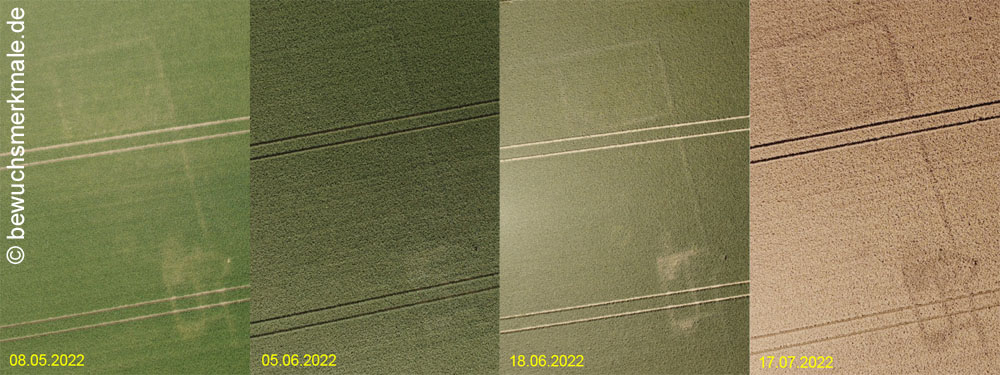
If a waypoint flight is repeated over several years, interesting areas of a ground monument can be compared over longer periods of time. Often ground monuments extend over several farmland areas and are therefore usually only partially recognisable in one year due to vegetation features. If such ground monuments are flown over several years by waypoint flight, the resulting images can be superimposed and supplemented to form an overall plan of the monument.
Large-scale ground monuments
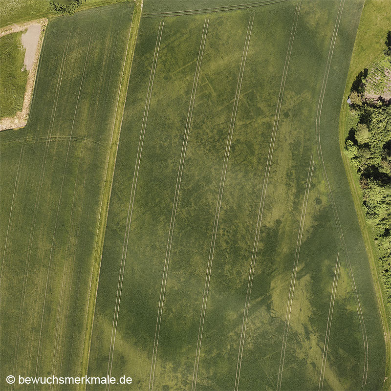
One disadvantage of aerial archaeology with a drone is the maximum permitted flight altitude of 120m. When flying over large-area archaeological monuments, this height is not sufficient to take vertical images of the monument, so that only oblique images are possible. This problem can be solved by flying over the entire monument (from a lower altitude) in a chessboard fashion using waypoint flights and taking overlapping vertical images at regular intervals. These perpendicular images can then be compiled into a high-resolution orthophoto using photogrammetry or StructureForMotion (SfM) software.
Own experience
The DJI mini-drones that I use do not support the ability to fly to waypoints from the manufacturer. However, there are various software providers who, after the release of the Software Development Kit (SDK) for the drones by the manufacturer, provide a corresponding app that makes this and other functions available. I myself use the product Litchi. In addition to the actual app for the Android and iOS mobile phone operating systems, Litchi also provides a website for planning and saving waypoint flights very conveniently. These waypoints can then be loaded from the app in the field and then executed.