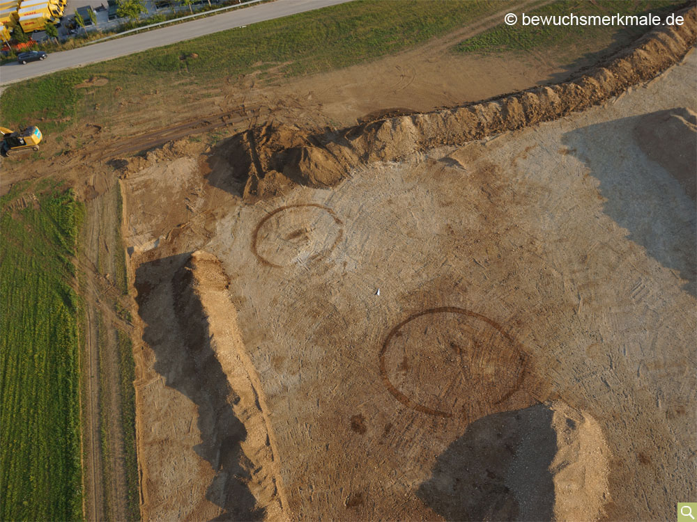
Positive crop marks of two circular ditches
The spring and early summer of 2016 in the Munich area were very wet and characterised by frequent and continuous rain showers. As a result, the plants had an optimal water supply, there was a delay in maturity and only sporadic development of crop marks. Both of the already known ditches south of Aschheim (district of Munich) that were flown over in this example were therefore only faintly visible in the low morning sun.
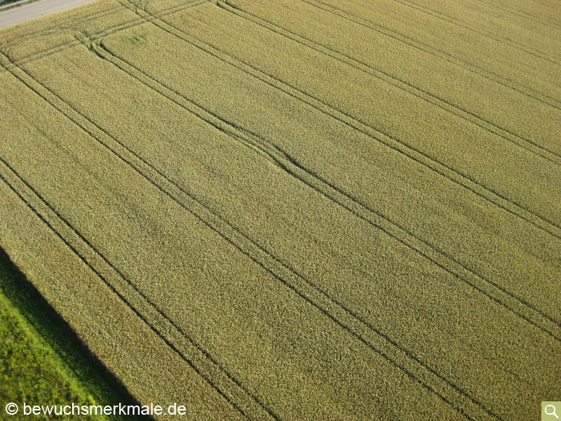
Shortly afterwards, the site was flown over again with the IR camera. The contours of the circular ditches stand out more vividly in the IR image.

Addendum 2018: In the course of a car park extension, this field area was built over in 2018, so that an excavation of the former burial mounds became necessary. In addition to the two circular ditches already recognised in the aerial photograph, at least one more was added, which can be seen at the lower, left edge of Fig. 3. In addition, numerous post pits were documented, which could be combined, among other things, to form house foundations and grave enclosures or annexes. In the more northerly of the two circular ditches (on the left in the picture), a double burial was recovered despite the fact that it had been ploughed over for centuries. The finds made during the excavation and the other areas of this cemetery excavated in previous years date the findings to the Middle to Late Bronze Age (ca. 1800 - 900 BC).